

Kaliningrad appears at first glance to be a geographical paradox on the map of Europe: a Russian enclave cut off from the main body of Russia, positioned between Poland and Lithuania, with direct access to the Baltic. In reality, however, it is much more than an isolated Russian enclave. It is one of the most characteristic remnants of the vast post-WWII redesign of the European continent and, simultaneously, one of the most sensitive flashpoints in the current strategic confrontation between Russia and NATO. What would happen if anyone attempted to... "touch" it? 
The military reinforcement of the Alliance's eastern flank, border fortifications, transit restrictions, the shifting balance in the Baltic, and increasingly blunt statements by military officials regarding a direct conflict have transformed Kaliningrad into a paramount geopolitical flashpoint. Yet behind the missiles, bases, and military scenarios lies an even larger and far more dangerous question. What would happen if someone attempted to challenge not merely the military utility of Kaliningrad, but its very sovereignty status today? If the argument were that the region was once German and that its current status is a product of 1945 decisions, the discussion could not easily stop there. It would automatically reopen the entire archive of post-war Europe: former German regions of modern Poland, border shifts in Central Europe and the Balkans, and even cases like the Dodecanese islands in the Aegean, whose modern sovereignty is also linked to post-war treaties. That is precisely where the real Pandora's box lies: not in whether a single border can change, but in what would follow if Europe accepted that the outcomes of 1945 can be reopened for overall renegotiation.
Kaliningrad as a product of the post-war map
To understand the current confrontation, one must return to the end of World War II. The region known today as Kaliningrad constituted the northern part of East Prussia, centered around Königsberg, a historic German city of immense cultural and strategic significance. After the defeat of Nazi Germany, however, the victorious powers did not limit themselves to regime change in Berlin or the occupation of German territory. They proceeded with an unprecedented restructuring of the entire European map, shifting borders, ceding regions, and accepting massive population transfers as part of the new post-war order. At the Potsdam Conference in 1945, the Soviet side raised the issue of acquiring Königsberg and its surrounding area. The US and Great Britain accepted this post-war arrangement in principle, to be incorporated into the broader final peace settlement. In 1946, Königsberg was renamed Kaliningrad and incorporated into the Soviet Union, while the local German population had already decreased dramatically due to flight, evacuation, and post-war expulsions. Populations from various parts of the Soviet Union were subsequently settled there, creating the westernmost region of the Russian Soviet Republic. None of this occurred in an international legal vacuum. During the same period, similar and often larger changes were taking place across Central and Eastern Europe.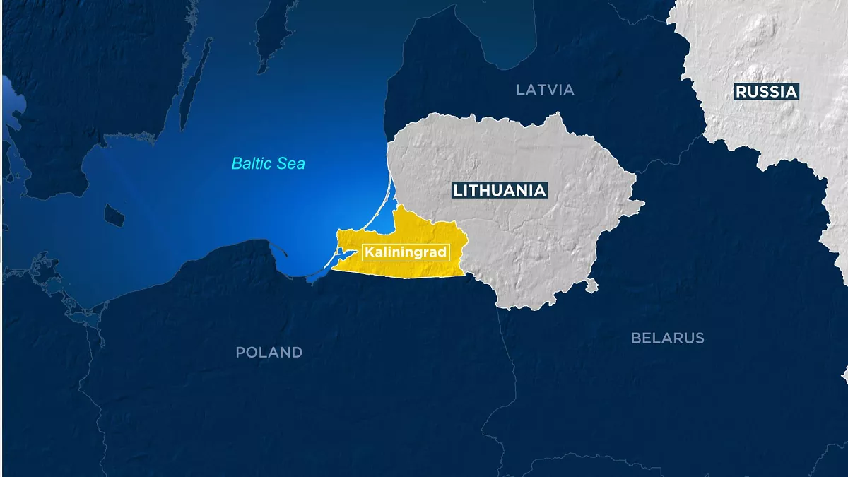
Poland shifting westward
Perhaps the most characteristic example of this massive rearrangement is Poland. Pre-war Poland had a completely different geographical shape than today. Pre-war Polish territory extended much further east, encompassing cities and regions outside its current borders. After the war, Joseph Stalin's regime did not return these territories to Poland. Instead, Polish borders were shifted westward, resulting in the country losing roughly 180,000 square kilometers in the east while acquiring approximately 100,000 to 105,000 square kilometers of former German territory in the west and north. This change was not a minor border correction; Poland's entire geographical footprint shifted roughly 200 kilometers west. Breslau became Wrocław, Stettin became Szczecin, and Danzig became Gdańsk. Alongside borders, demographic realities changed completely. Millions of Germans fled or were expelled from territories ceded to Poland, while new populations moved in. By modern political standards, these mass movements would trigger intense debates over forced expulsions and ethnic cleansing, yet at the time, they were integrated into post-war settlement logic. Borders were drawn first, and populations adjusted to the new map later.
The problem of "historical justice"
Here lies the fundamental problem of any debate surrounding the "return" of Kaliningrad. If one argues that the region must be re-evaluated because it was once German Königsberg, one must explain why the status of other former German cities in Poland should not be re-evaluated as well. Why should Wrocław be considered permanently Polish while Kaliningrad is treated differently? Why should Szczecin or Gdańsk be exempt from the same historical logic? If the answer rests solely on pre-1945 status, it opens an endless chain of questions. An even larger issue is deciding which historical date serves as the correct starting point. Choosing 1939 reveals one map; choosing 1914 reveals an entirely different one. Reaching back to the 19th century places much of modern Europe inside long-defunct empires. The further back one goes, the more nations can present historical maps depicting far larger territories than today. This is precisely why the post-war European system did not attempt to construct a "historically perfect" map. It sought to establish a definitive map to prevent perpetual historical revisionism from triggering new wars.
How the debate reaches the Aegean
At this point, the Dodecanese islands offer a compelling parallel, illustrating how modern European geography was forged through post-war treaties. Before World War II, the Dodecanese were under Italian sovereignty. Through the Paris Peace Treaties of 1947, sovereignty over the archipelago was transferred to Greece, with Rhodes, Kos, Kalymnos, Leros, Patmos, Karpathos, Symi, Kastellorizo, and remaining islets permanently joining the Greek national territory. This transfer did not involve negligible rocks, but an entire island region covering approximately 2,700 square kilometers in one of the most critical geopolitical hotspots of the eastern Aegean and Mediterranean. Mentioning this does not imply an active revision process regarding Greek sovereignty in the Dodecanese, nor that Kaliningrad links directly to modern Greco-Turkish territorial disputes. The example's significance is broader: it demonstrates that European geography is filled with borders established or finalized after two world wars. If Europe accepted the principle that any post-war settlement could be reopened due to prior historical ownership, that logic would not stop at the Baltic. It could theoretically reopen historical disputes across the continent, from Central Europe to the Balkans and the Aegean.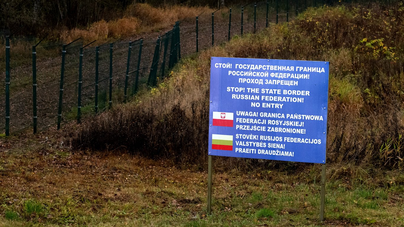
1990 and the final acceptance of German borders
Another critical chapter is the German reunification in 1990. For decades after WWII, arguments persisted that because no single comprehensive peace treaty was signed between Germany and all victorious powers, certain post-war settlement issues remained open. However, the Two Plus Four Agreement accompanying reunification largely closed this debate. Reunified Germany accepted its existing external borders as final, committing to make no territorial claims against other states. This means modern Germany claims neither Wrocław, Szczecin, Gdańsk, nor Kaliningrad. Here lies one of the central contradictions of the debate: modern Russian sovereignty over Kaliningrad and modern Polish sovereignty over vast former German regions derive from the exact same post-war framework. Consequently, challenging one case without creating a precedent to challenge others is virtually impossible. That is why, despite aggressive political rhetoric surrounding Kaliningrad, major European governments strictly avoid formally opening the issue of its territorial sovereignty.
Why Kaliningrad returned to center stage
Current tensions surrounding Kaliningrad stem not from historical claims, but from military geography. Until 1991, Kaliningrad served as a western military outpost of a vast Soviet Union. Poland belonged to the Warsaw Pact, Lithuania was part of the USSR, and the entire region operated within a completely different strategic environment. Following the collapse of the Soviet Union and successive NATO enlargements, the picture reversed. Poland and the Baltic states joined the Alliance, later followed by Finland and Sweden. Thus, Kaliningrad transformed from an advanced outpost of a massive block into an isolated Russian region almost entirely encircled by NATO members. Despite its isolation, its strategic importance remains immense. The enclave hosts elements of the Russian Baltic Fleet, air defense systems, missile capabilities, and major military infrastructure. For Moscow, Kaliningrad is a critical bastion allowing Russia to maintain a heavy military footprint deep inside the Baltic sphere. For NATO, that same geography represents a heavily armed Russian enclave positioned directly adjacent to member states and key supply corridors.
The Suwalki Gap and the fear of detachment
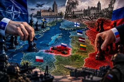
A vital component in this strategic equation is the Suwalki Gap, the border corridor between Poland and Lithuania connecting the Baltic states by land to the rest of NATO territory. In a hypothetical conflict scenario, the Alliance fears Russian and Belarusian forces could attempt to sever this corridor, creating a land bridge between Belarus and Kaliningrad while isolating the Baltic states. Russia views the same corridor from the opposite perspective, calculating the risk that NATO forces might isolate Kaliningrad and neutralize its military infrastructure. The defining feature of this confrontation is that both sides' fears mirror each other. One side fears a Russian operation to cut off the Baltics, while the other fears Western efforts to militarily strangle Kaliningrad. For years, such scenarios remained confined to command exercises. Today, they are discussed openly, heightening mutual suspicion and causing any military movement to be easily interpreted as preparation for an attack.
Christopher Donahue's statements and new military language
Considerable attention has been drawn to statements and military positions associated with US General Christopher Donahue regarding NATO's eastern flank and capabilities for rapidly neutralizing Russian military installations. Within Western military planning, Kaliningrad is viewed as a zone heavily fortified with A2/AD capabilities designed to restrict operational freedom for opposing air and naval forces. In a major conflict, neutralizing these systems would represent an immediate military priority for NATO. However, a distinct line exists between operational planning to destroy military installations during wartime and a plan to occupy or annex the territory altogether. The former is a matter of open military doctrine; for the latter, no evidence exists. Nonetheless, in information warfare, the distinction quickly blurs. Western commentary frames discussions as deterrence strategy against potential Russian aggression, whereas Russian public sphere commentary presents it as proof that NATO prepares to capture Kaliningrad.
From Kaliningrad to Królewiec: The war of symbols
The confrontation extends beyond military dimensions. In 2023, Poland officially recommended using the historical Polish name Królewiec instead of Kaliningrad, triggering sharp reactions in Russia. The move carried clear political and historical symbolism, rejecting the city's Soviet namesake in favor of an older name with deeper European roots. Russian officials characterized the decision as clear evidence of hostile attitudes toward Russian sovereignty. Polish authorities maintained that the change was purely symbolic and linguistic, carrying no territorial claims. This distinction is crucial: in times of heightened geopolitical conflict, even naming conventions become tools of political confrontation. Yet symbolic moves do not equate to operational plans for border revisions, though Kaliningrad has become such a potent symbol that the very words used to describe it carry strategic weight.
Transit access and fears of future blockade
Another critical issue concerns transit links between Kaliningrad and mainland Russia. Following European sanctions, movement of certain goods through Lithuania became subject to strict controls and quotas. However, rail transit has not been completely cut off, meaning the term "blockade" does not accurately describe the current status. Moscow's real concern lies elsewhere: the vulnerability of supply lines if the current standoff escalates into direct military conflict. In such a scenario, Kaliningrad would quickly face severe supply challenges, becoming entirely reliant on Baltic maritime routes. This explains why transit restrictions carry immense political weight for Moscow. Every new restriction or inspection is framed by the European Union as standard sanctions enforcement, but interpreted by Moscow as a step toward isolating the region during a crisis.
The new Baltic alters strategic calculations
The accession of Finland and Sweden to NATO dramatically altered the geopolitical landscape of the Baltic Sea. Almost the entire coastline, excluding Russian territory, now belongs to Alliance members. While this does not legally turn the Baltic into a "NATO lake"—as international waters remain governed by international law—the balance of power, maritime surveillance, and naval control have shifted decisively. For Russia, this shift represents a gradual strategic encirclement of Kaliningrad and a constriction of Russian movement in the Baltic. Conversely, NATO frames this military buildup as a necessary response to Russian capabilities and vital protection for eastern members, maritime routes, and undersea infrastructure. This creates a classic security dilemma: one side reinforces out of fear, the other views it as aggressive and responds in kind, driving a continuous spiral of escalating concern.
When Kaliningrad becomes a political tool
There is also a dimension beyond pure military strategy. Major increases in defense budgets require domestic political consensus and economic sacrifices. Procuring air defense systems, missile units, fortifications, and supply depots costs billions, requiring governments to justify expenditures to their publics. Kaliningrad serves as a highly effective symbol in this debate, framing threat perception not as an abstract concept, but as a heavily militarized Russian outpost sitting on NATO's doorstep. This does not mean the military threat is imaginary or manufactured purely for internal political consumption. It indicates that a genuine strategic threat can simultaneously yield significant political utility. Maps are easy to understand, distances are short, and the image of a Russian military "fist" embedded among NATO allies resonates far more effectively with the public than complex analyses of naval strategy.
The ultimate taboo: Redrawing the map
Despite escalating military tensions, almost no major power demonstrates a willingness to open the official taboo: revising the territorial status of Kaliningrad. If a major European power accepted that the region's sovereignty could change because it was once Königsberg, it would set a precedent with ramifications extending far beyond the Baltic. It would reactivate debates over former German lands in Poland, shifts in Central Europe, Transcarpathia, Transylvania, Istria, Vyborg, and dozens of other regions remapped during the tumultuous 20th century. This context highlights the relevance of the Aegean reference. The Dodecanese are not an active example of post-war revisionism, but a reminder that modern Greek geography was formalized through post-WWII international treaties. The underlying issue is not whether Kaliningrad has a complex history—dozens of European regions do—but whether history will once again be accepted as a valid basis for forcibly altering modern borders.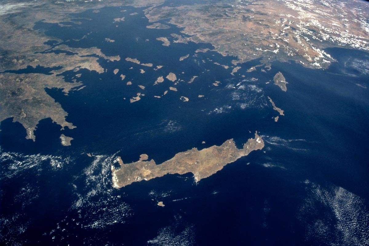
From the Baltic to the Aegean: The domino effect nobody wants to start
Modern Europe is filled with cities and regions that existed under different sovereignty a few decades or centuries ago. Kaliningrad was Königsberg, Wrocław was Breslau, Szczecin was Stettin, and Gdańsk was Danzig. The Dodecanese were under different rule before 1947, and across Central and Eastern Europe, current maps reflect the outcome of wars, treaties, and mass population movements. Current borders were not drawn because a perfect historical resolution was found; they were established because, after two world wars, nations recognized that endlessly relitigating the past leads to conflict.
This is why the true significance of Kaliningrad extends far beyond its military value. The region stands as a core symbol of Europe's post-war border framework. If one pulled on this thread, no one could predict where the unraveling would stop. The debate could begin in the Baltic, move into Central Europe, and touch historical cases down through the Balkans to the Aegean. The truly dangerous question is not merely who owns Kaliningrad today, but what happens to Europe if someone decides the map of 2026 can be redrawn based on the maps of 1945, 1939, or earlier eras. If the first domino falls, no one can guarantee where the last one will land.
www.bankingnews.gr



Readers’ Comments