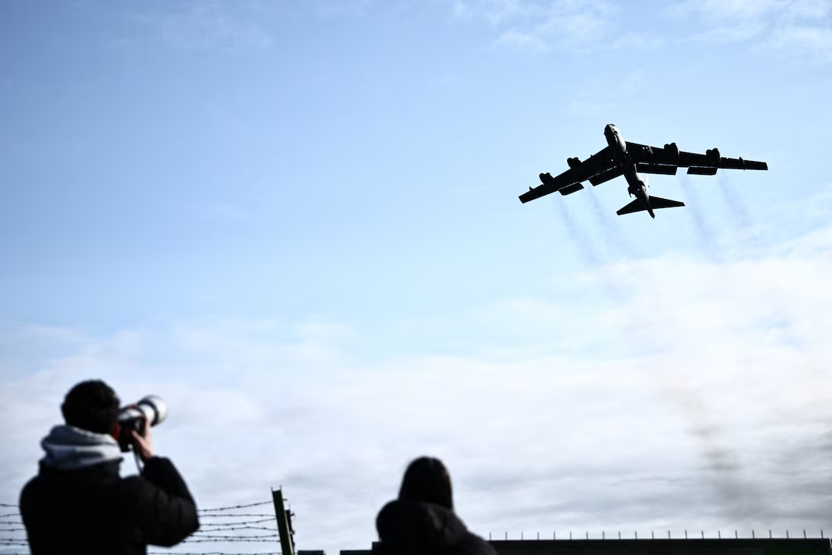
In a war where missiles and drones draw the spotlight, a less visible but equally critical dimension emerges, the battle for information from space.
China appears to have filled a critical gap in favor of Iran, providing satellite imagery at a time when the United States has restricted access to such data, according to analysis by the Economist.
This is not a technical detail.
It is a strategic development that changes the rules of the game.
From “civilian” technology to military tool
The critical change does not concern new weapons. It concerns data.
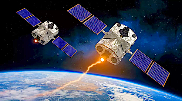
High resolution satellite images, typically promoted as commercial or civilian services, have now been deeply integrated into military practice.
This means that target monitoring becomes continuous, troop movements do not go unnoticed while decisions are based on near real time data.
The difference is enormous, from a snapshot we move to constant surveillance.
What the reports show
Iran gained access to a Chinese satellite system already from 2024 and used imagery to monitor United States bases.
The areas included Saudi Arabia, Iraq, Jordan and the Persian Gulf
The images are said to have been detailed enough to:
1) detect aircraft
2) map infrastructure
3) monitor changes in activity
This does not necessarily mean they guided attacks. It does mean, however, that they significantly improved understanding of the battlefield.
The dispute over the truth
The claims are not undisputed.
The American president Donald Trump stated that he received assurances from his Chinese counterpart Xi Jinping that Beijing did not provide weapons.
China completely rejected the accusations, speaking of “fabricated rumors”.
However, the critical point is not whether there was direct military cooperation.
It is that the technology exists and is accessible.
The revolution of commercial satellites
The biggest change in modern warfare is the “democratization” of information.
According to studies by the RAND Corporation, commercial satellites are now systematically used in military missions, they provide high frequency imagery many times per day and allow continuous monitoring of activities
This means that the battlefield becomes fully “visible”.
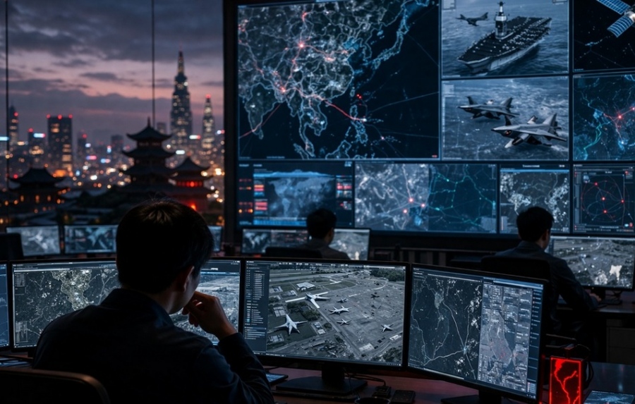
Integration into the military system
According to the RAND Corporation, commercial satellite data do not operate independently.
They are fully integrated into ISR (Intelligence, Surveillance, Reconnaissance), military networks and decision making systems
That is, they form part of the war mechanism itself
China has invested in a model that stands out, development of dual use technology, connection of civilian and state actors and creation of a data ecosystem
This allows it to influence conflicts without direct military involvement.
A kind of “indirect power” that is difficult to counter.
From observation to targeting
The development does not stop at monitoring.
According to analyses by the International Institute for Strategic Studies and the RAND Corporation, satellite data are now used for target detection, attack planning and damage assessment
The information is integrated across the entire operational cycle.
China applies a particular model, merging the civilian and military sectors
Technologies developed for commercial use can be exploited militarily, without being declared as such, and without direct involvement of the state
This creates a “gray zone” where responsibility is difficult to assign.

A new kind of strategic advantage
Access to satellite data does not replace other intelligence means.
But it offers something unique, continuity and speed in understanding the field
This allows faster decisions, better preparation and more accurate risk assessment
The risks of dependence
The increasing use of commercial satellites also creates new vulnerabilities.
Providers become targets while service disruption can affect operations.
Dependence on external data increases risk
Information becomes both power and weakness.
The war of information has already begun
The case of the use of Chinese satellites by Iran is not just an incident.
It is an indication of a deeper change, wars are becoming increasingly digital, information becomes a central weapon while access to data determines the balance of power
Even without proof of direct use in attacks, one thing is clear, whoever sees better, fights more effectively.
And in this field, the game has just changed.
The sale of information
At the same time Chinese companies traded information about the war in Iran, “revealing” American forces
Private companies, some with ties to the military, provided detailed information on the movements of American forces.
Since the outbreak of the war in Iran on 28 February 2026, users on social media on Western and Chinese platforms pointed to a wave of posts describing equipment at American bases, the movements of American aircraft carriers and detailed analyses of how military aircraft were assembling for raids on Tehran.

Use of artificial intelligence and open sources
This information comes from a rapidly growing market, Chinese companies, some with ties to the People’s Liberation Army, combine artificial intelligence with open source data to market information that they claim can “reveal” the movements of American forces.
Beijing has sought to distance itself from any direct involvement in the war in Iran, but the companies, many of which emerged in the last five years as part of the government’s effort to leverage private artificial intelligence for military use, are exploiting the conflict.
American officials and intelligence experts are divided on whether the publicly marketed tools of Chinese companies constitute a real threat or whether they can be reliably used by adversaries of the United States, but they note that the increase in private sector offerings indicates a growing security risk and reflects Beijing’s intention to project the strength of its capabilities in the intelligence sector.
Beijing has invested hundreds of millions of dollars to support private companies developing AI with practical defense applications as part of its strategy for civil military technological integration, and last month announced plans to strengthen these efforts as part of a broader five year national strategy.
Flight trackers
Private companies have long used open source data, such as flight trackers, satellite images and maritime data, to produce marketable intelligence.
However, the increasing capability of Chinese companies in artificial intelligence makes these tools more powerful, highlighting the growing challenge of concealing United States military movements from adversaries.
“The proliferation of increasingly capable geospatial analysis companies in the private sector in China will strengthen China’s defense capabilities and its ability to challenge United States forces in a crisis,” said Ryan Fedasiuk, a fellow at the think tank American Enterprise Institute.
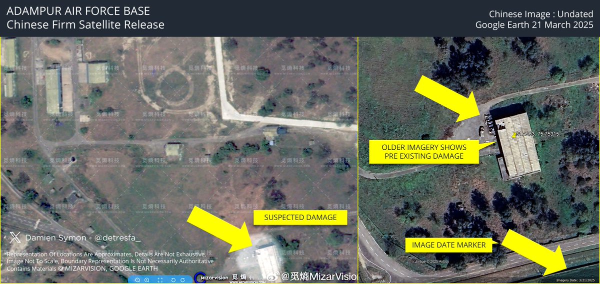
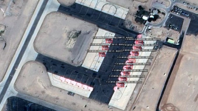
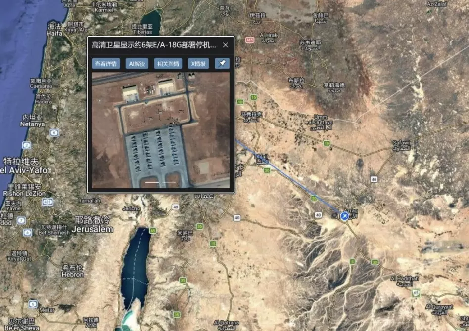
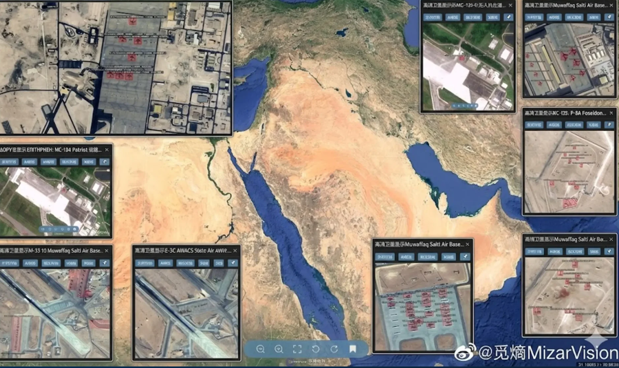
MizarVision, a company based in Hangzhou and founded in 2021, is one of the companies that uses a mix of Western and Chinese data filtered through AI to record activity at American bases in the Middle East, monitor naval movements and determine the position and number of specific aircraft and air defense systems.

Relations with the CCP and the military
Images published by the company, which is not part of the Chinese military but holds National Military Standard certification required for companies that provide services to the military, and posted on Chinese and Western social networks, depicted the deployment of American forces in the Middle East before the start of the operation Epic Rage, including the aircraft carriers USS Gerald R. Ford and USS Abraham Lincoln.
Detailed analyses were also published on the number and types of aircraft at bases Ovda Air Base in Israel, Prince Sultan in Saudi Arabia and al Udeid Air Base in Qatar.
Early warning
MizarVision claims on its website that “in the context of escalating tensions in Iran in 2026, we quickly identified the positions of weapons and equipment in the Middle East” and “revealed the resupply patterns of American aircraft carriers”.
Elsewhere it claims that it tracked the escalation of American military operations before the operation to capture the President of Venezuela, Nicolás Maduro, “months earlier”, and that it can “monitor the entire transfer process” of American intermediate range missiles to the Pacific in “real time”.
MizarVision also does not disclose the sources of the data it analyzes, including satellite images, flight data ADS B and maritime data AIS, although image analyses and user reports indicate that it draws data from Chinese and Western sources.
Satellite images posted by MizarVision appear to include images from providers in the United States and Europe, such as Vantor and Airbus.
Chinese state media also reported that the company has used images from Planet Labs.
It is not clear whether American companies provide data directly to MizarVision.
Major providers usually restrict or prohibit such uses.
www.bankingnews.gr


Readers’ Comments